As technology continues to advance at almost an exponential rate, industrial manufacturers who conceptualize, design and create position sensors are presented with a wide array of not only new concepts but improvements and updates on existing technologies.
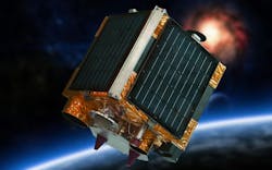
The use of the global positioning system (GPS), originally created by the U.S. military, has improved through not only additional satellites, but wider bandwidth and increased rate of data transfer. These systems are widely used for outdoor positioning by relying on signals from satellites to determine accurate location coordinates.
Furthermore, once position has been established, inertial measurement units (IMUs) use accelerometers and gyroscopes to measure changes in velocity and orientation, enabling the determination of position changes.
Laser applications
Laser technology has been applied to many different measurements, from tuned laser diodes (TLDs), used in industrial gas composition makeup to light detection and ranging (LiDAR), which uses laser beams to measure distances, creating detailed 3D maps of the surroundings. LiDAR is often used in autonomous vehicles and robotics. In this latter application, laser displacement sensors, also known as laser distance sensors or laser rangefinders, use a laser beam to measure the distance to a target object.
These devices function as follows: The sensor emits a laser beam toward the target, and a photodetector in the sensor measures the time it takes for the laser light to reflect off the target and return to the sensor. The distance is then calculated based on the speed of light and the time of flight.
Furthermore, when high accuracy of position is required, laser interferometry comes to the fore. This laser interferometry utilizes the interference of laser light waves to measure small displacements with high precision.
Here, a laser beam is split into two paths, with one directed to a fixed reference surface and the other to the target object. The reflected beams are then recombined. Changes in the path length due to the movement of the target result in interference patterns, and the interference fringes are counted to determine the displacement.
Often used for the establishment of distance, the concept of laser triangulation has been successful. In this application, the simple geometry of triangles is used to determine the distance to an object. In practice it works like this: A laser beam is projected onto the target surface at an angle. The position of the laser spot on the surface is observed by a photodetector, and the displacement of the spot provides information about the distance between the sensor and the target.
Some very demanding position sensing requirements have resulted in advanced systems known as laser encoder systems. Because of the high accuracy demands, laser encoder systems use the interference pattern created by laser light to encode position information. Simply stated, a diffraction grating or similar optical pattern is generated on a surface, and a laser beam is directed onto it. The reflected light produces an interference pattern that can be detected and used to determine the position of the object.
The Doppler effect has been around for many years. Simply explained, the Doppler effect in physics is defined as the increase or decrease in the frequency of sound, light or other waves as the source and observer move toward or away from each other.
Enter laser Doppler effect physics: Laser Doppler velocimetry (LDV) measures the velocity of a target surface. In operation, a laser beam is directed onto the moving surface, and the frequency shift—Doppler shift—of the reflected light is measured. The velocity of the surface can be determined based on this shift.
Satellite laser ranging (SLR) is a very precise, laser-based method for determining the distance between a satellite and Earth with an accuracy of a few millimeters. SLR is primarily used in geodesy. This is because the precise measurement of satellite orbits helps to determine changes in Earth's structure and rotation. The SLR method also makes important contributions in the field of satellite navigation.
Non-laser focus
That’s quite a number of laser technology applications. Now let’s highlight other forms of position-measurement technology advances.
Magnetism and the Earth’s magnetic field have been applied for generations for magnetic position sensing. This technology uses the Earth's magnetic field for position detection. In addition, magnetometers are often employed in combination with other sensors to fulfil this function.
In the industrial instrumentation concept, ultrasonic sensors have for many years been applied in flow metering, thus eliminating the need to insert measurement technology within piping.
Simple clamp-on ultrasonic sensors are effective in this application as well as the use sound waves to measure distances which are commonly used for short-range position sensing in robotics and automation.
In the realm of vision systems, employing smart cameras, computer vision is combined with AI-enabled software and image-processing algorithms to determine position based on visual input. This is often used in applications like object tracking and augmented reality. These new camera systems have revolutionized production control on conveyor belts.
Further uses of sound or ultrasonics is employed via radio frequency identification (RFID), which uses radio waves to identify and track objects, making it useful for position sensing in logistics and inventory management.
For outdoor applications, GPS remains the top contender, but what about indoor positioning systems? Various technologies, such as Wi-Fi, Bluetooth and beacons, are employed for indoor positioning where GPS signals may be weak or unavailable.
About the Author

Charles Palmer
Charles Palmer is a process control specialist and lecturer at Charles Palmer Consulting (CPC). Contact him at [email protected].
Sign up for our eNewsletters
Get the latest news and updates

Leaders relevant to this article:
